7 ONTARIO GEOLOGICAL WONDERS
AMAZING GEOLOGICAL SITES IN SOUTHERN ONTARIO POINTING TO
CATASTROPHE AND QUICK PROCESSES.
SITES YOU CAN ACTUALLY VISIT!
AMAZING GEOLOGICAL SITES IN SOUTHERN ONTARIO POINTING TO
CATASTROPHE AND QUICK PROCESSES.
SITES YOU CAN ACTUALLY VISIT!
NUMBER: 1
EVIDENCE: CATASTROPHE
EVIDENCE: CATASTROPHE
Rock N' Roll!
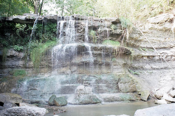
The Pot Holes of Rockwood Conservation Area, Rockwood Ont.
The Pot Holes of Rockwood Conservation Area, Rockwood Ont.
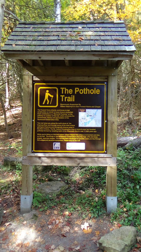
But these are not your highway 401 potholes but naturally formed ones.
A pot hole is formed when a round stone (a pot boiler) swirls around on bed rock by
turbulent water movement and eventually cuts a hole, even through several meters of rock!
Naturally formed potholes are found throughout Southern Ontario but are highly
concentrated at Rockwood. Over 200 have been documented! These are thought
to have been formed by the turbulent waters of retreating ice sheets near the
end of the Ice Age. The Ice Age is considered by creationists to be an aftermath of
the Flood which occurred about 4000 years ago.
|
|
|
|
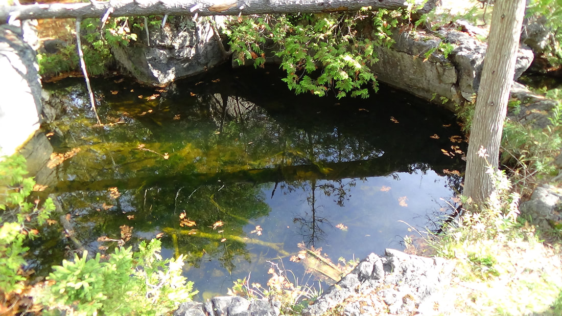
Assorted Rockwood Potholes
Here's a short video of assorted potholes.
How long does it take to create a pot hole? hundreds of years? Thousands?
It was thought that potholes took long periods of time to form but that is not the case anymore.
Now it is considered that potholes can only form quickly at the result of turbulent waters.
"The generally accepted belief is that high volumes of rapidly-flowing water, probably in an ice-marginal,
or possibly sub-glacial river enlarged weak points in the bedrock and established the site for a pothole".
https://uwaterloo.ca/wat-on-earth/news/glacial-potholes
Here is an incident recorded in a book “Geology of our Romantic Niagara” by A.H.Tiplin.
“It seems that while fishing in the rapids near the glen, a fisherman lost his lead sinker. It was about 1.3 centimeters (half-inch) in diameter and pear shaped, being about 5 centimeters (2 inches) long. About a month later, this was found somewhat lower down stream curiously embedded in a rock. It had ground out a hole about 2 centimeters (three - quarters of an inch) in width; sand was in the hole at the bottom and sides but only loosely; sand was also embedded in the lead of the sinker making it a rather effective sort of auger. The sinker had done a fair job of grinding with the sand because it was sitting up in a hole nearly as deep as its own height. Thus as the reader gazes at the various interesting eddies along the gorge he may be fairly sure that more pot holes are being formed in our river where ever the stream is swift.”
Editor's comment: If the lead sinker ground a hole nearly as deep as its own height in a month in swift water,
imagine what a six inch diameter pot boiler can do in turbulent water!
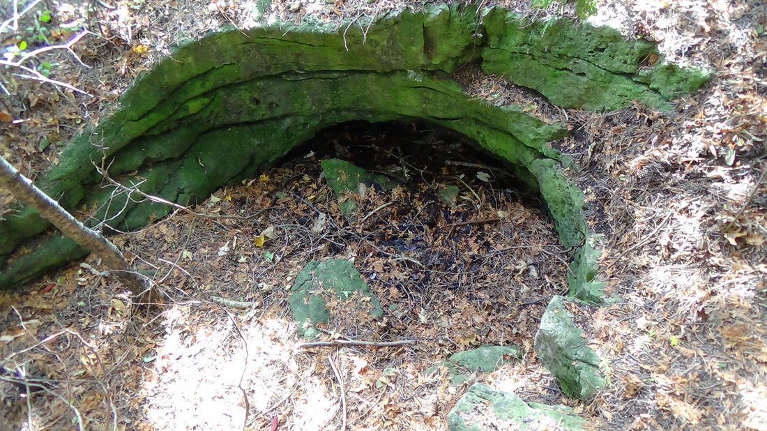
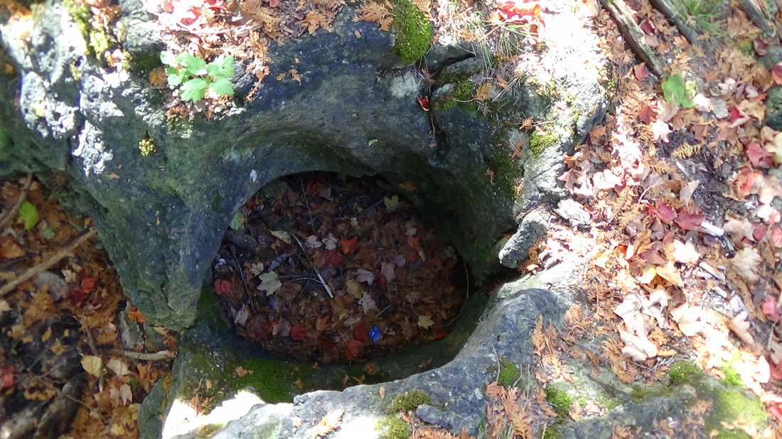
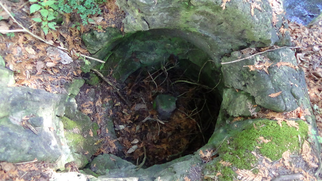
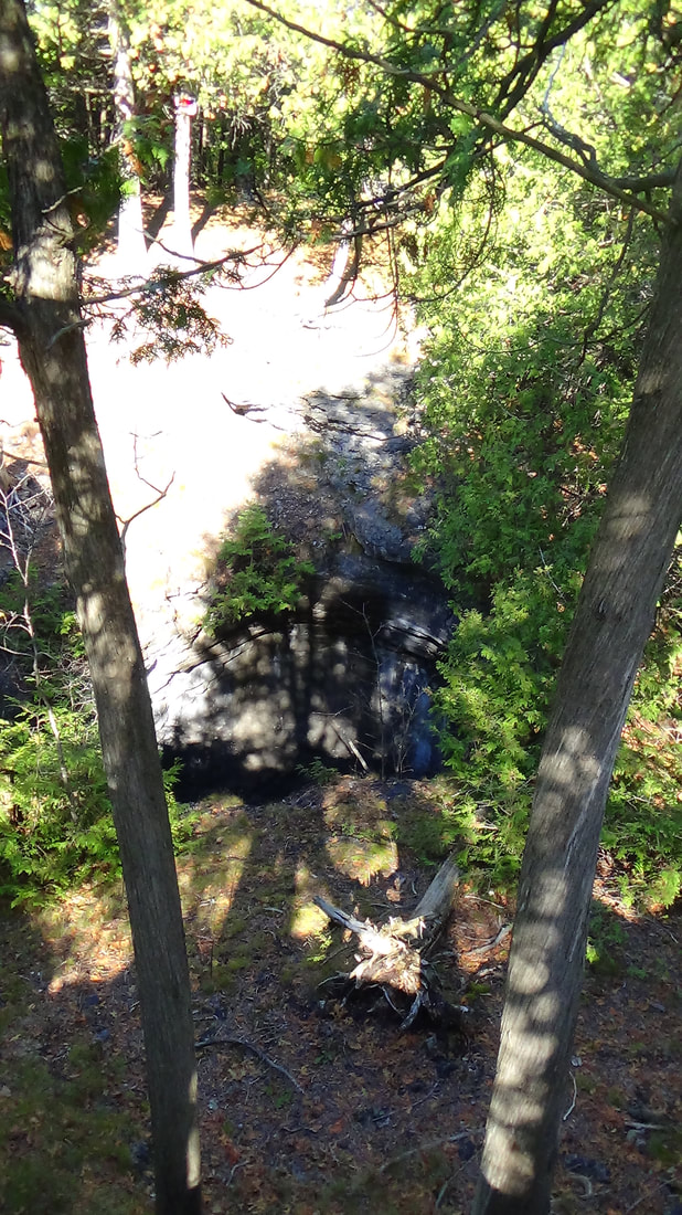
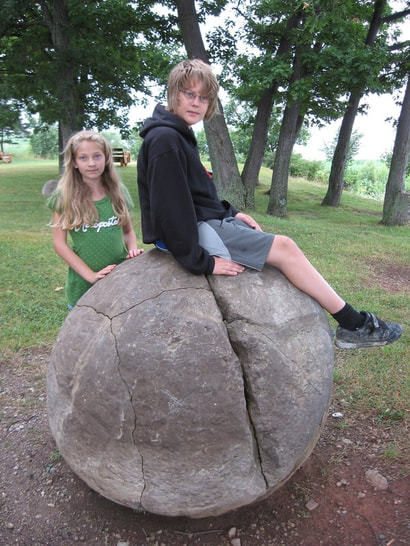
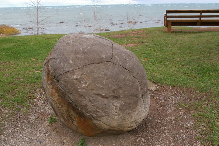
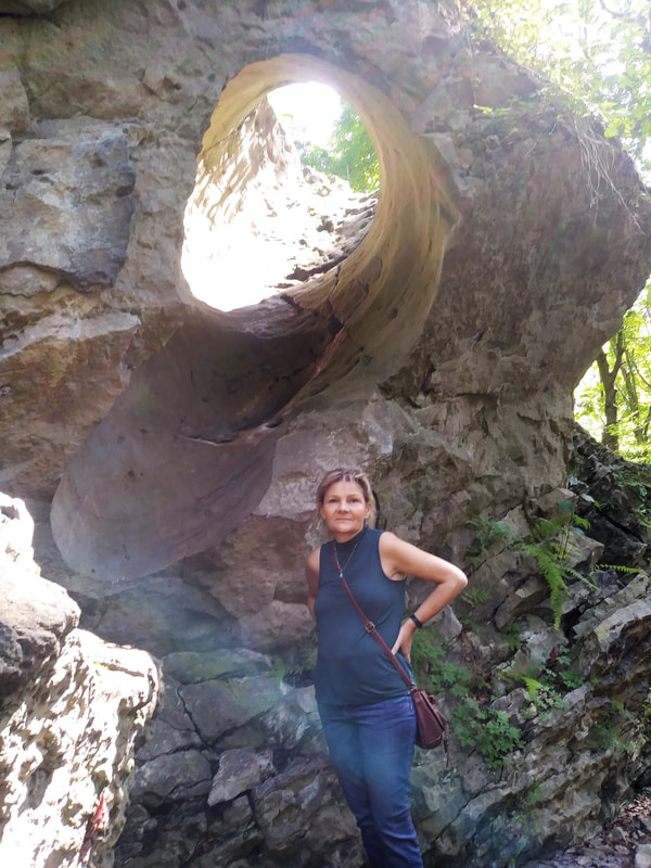
Although not in the park but nearby is apparently the world's largest pothole called "The Devil's Well". This was really hard to find as its location is not posted and the exact location can't be found anywhere on the internet.
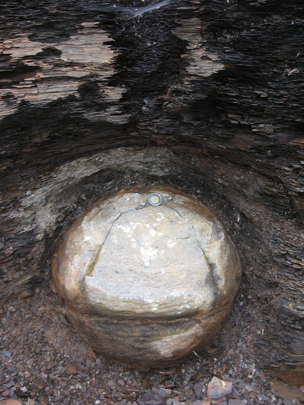
View from top
|
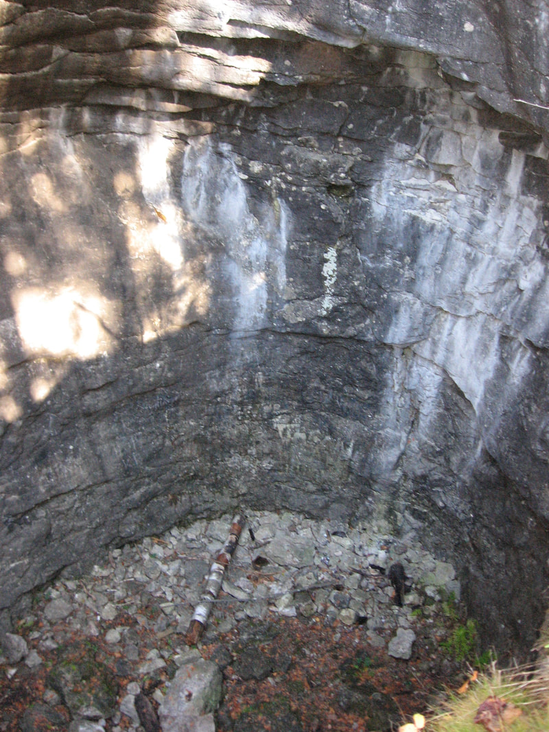
View from top looking down. That's not a stick down there. It's a mid sized tree trunk! The pothole opening is several meters above the waterline today indicating much more water in the past and that the water was turbulent.
|
Video filmed from the top
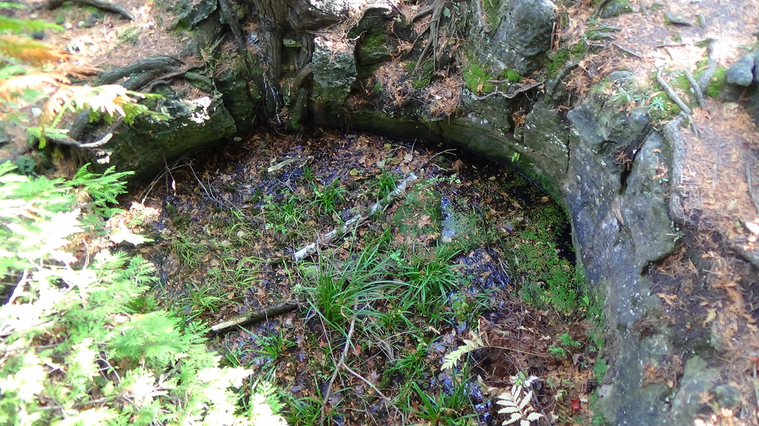
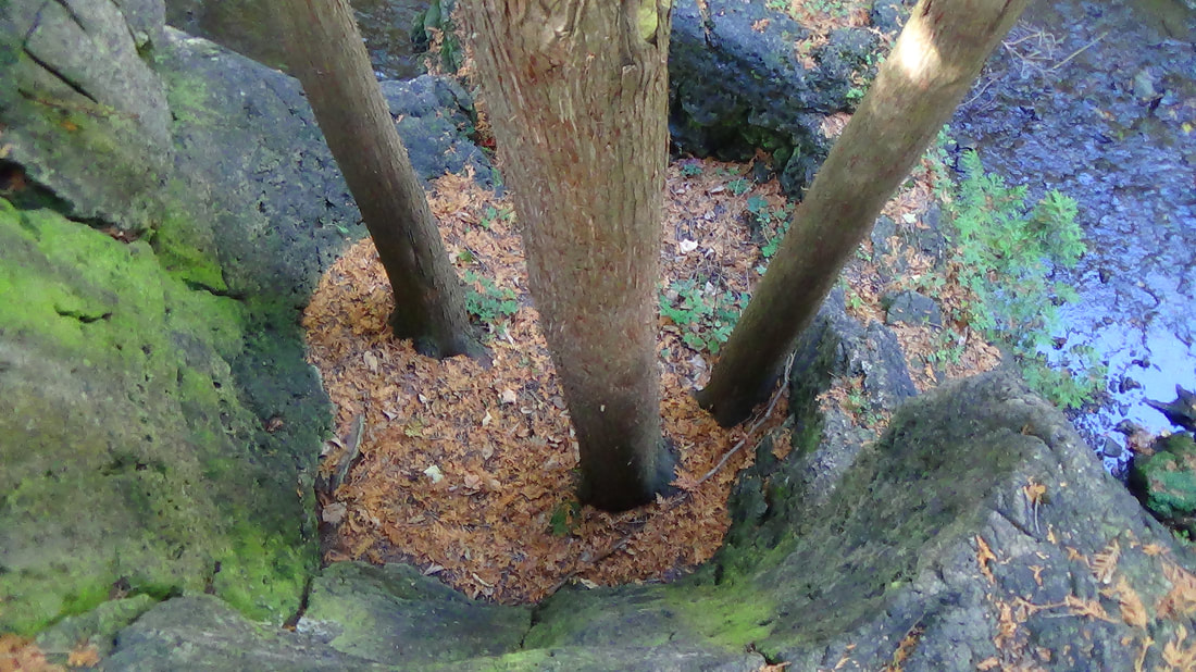
And here we enter from below!
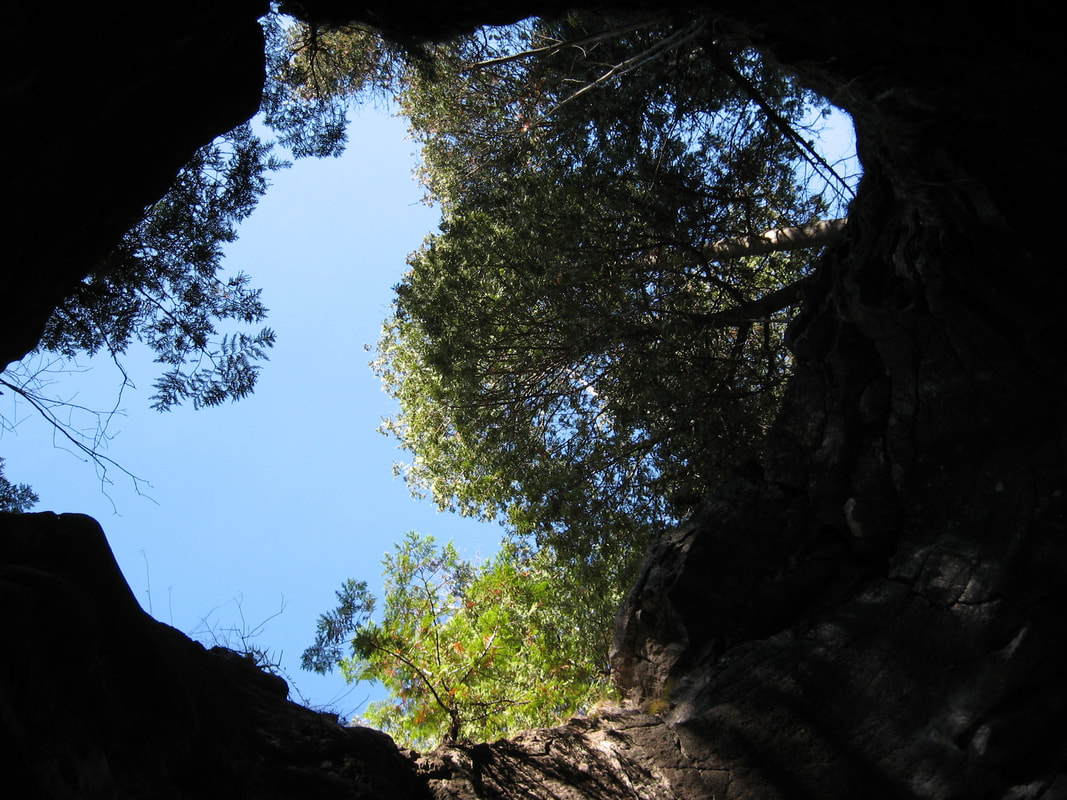
View from inside looking up.
|
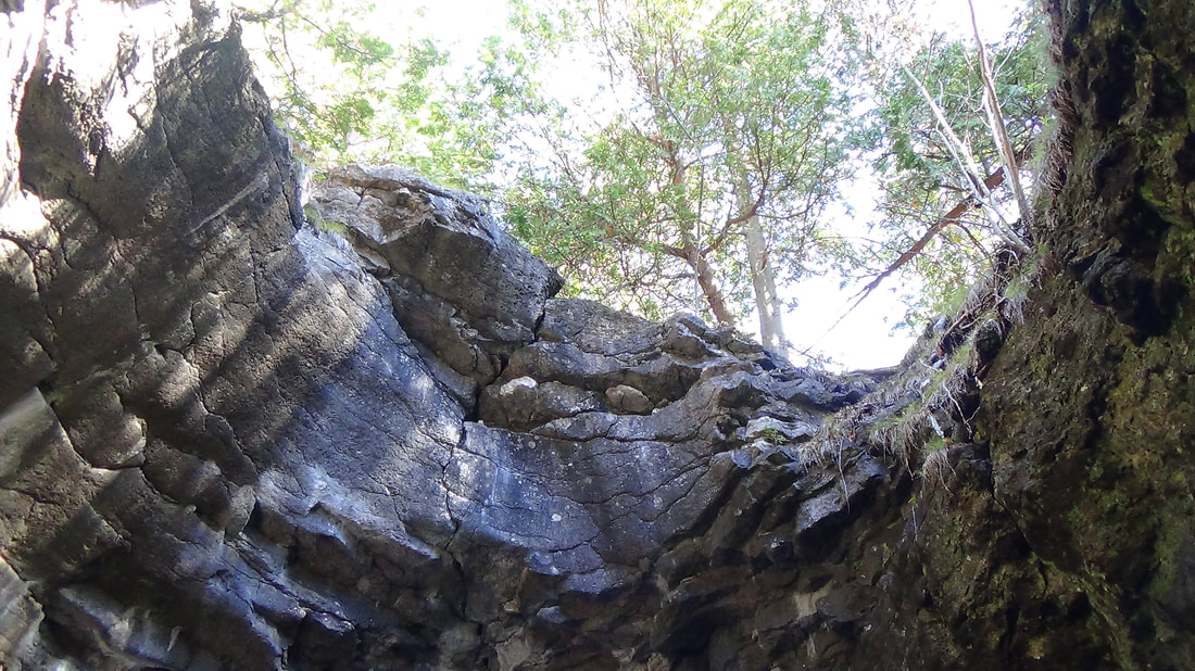
View from inside looking up.
|
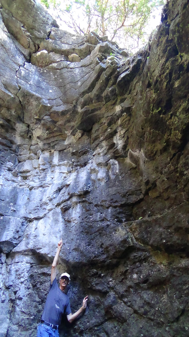
You can see the amazing height or I should say depth to which this pothole was carved out.
(The pothole is 13.1 metres deep and is 6.4 metres wide just below the rim at the top. The bottom tapers down to 4.9 metres. Source: https://hikingthegta.com/2015/11/30/the-devils-well/)
(The pothole is 13.1 metres deep and is 6.4 metres wide just below the rim at the top. The bottom tapers down to 4.9 metres. Source: https://hikingthegta.com/2015/11/30/the-devils-well/)
CONCLUSION
Large potholes are just not forming today. Potholes point to catastrophic forces that happened in the past. The earth is considered by evolutionists to be millions of years old only because these catastrophic events have been ruled out, such as the deluge; AKA Noah's Flood!
Large potholes are just not forming today. Potholes point to catastrophic forces that happened in the past. The earth is considered by evolutionists to be millions of years old only because these catastrophic events have been ruled out, such as the deluge; AKA Noah's Flood!
ROCKWOOD CONSERVATION AREA LOCATION
Use the interactive map to plan your route.
Use the interactive map to plan your route.
STATS:
ADDRESS: 161 Falls Street, Rockwood Ont.
TIME NEEDED IF IN GTA:1 day
FEE: Park entrance fee
AMENITIES: Washrooms, Picnic areas.
No hammering or collecting in the park.
ADDRESS: 161 Falls Street, Rockwood Ont.
TIME NEEDED IF IN GTA:1 day
FEE: Park entrance fee
AMENITIES: Washrooms, Picnic areas.
No hammering or collecting in the park.
NUMBER: 2
EVIDENCE: QUICK PROCESSES
EVIDENCE: QUICK PROCESSES
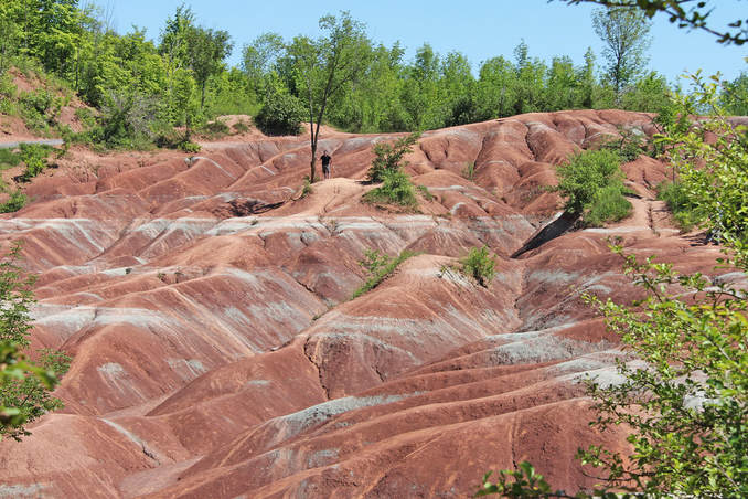
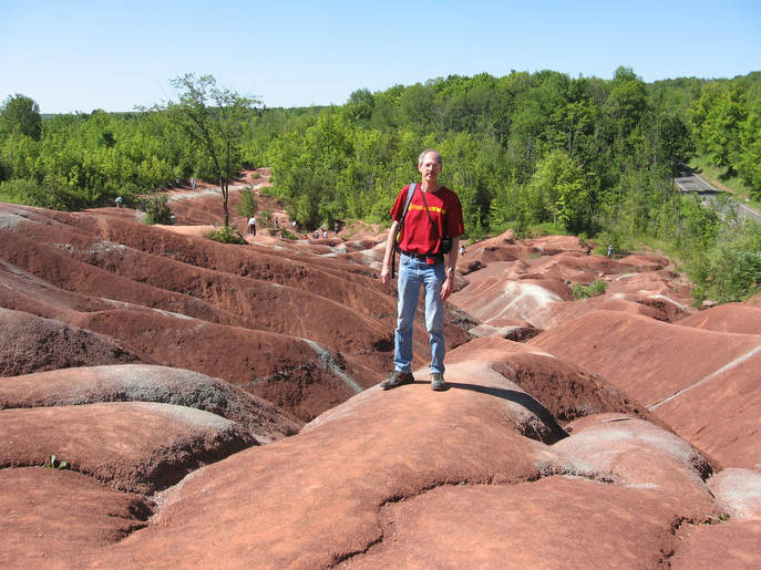
The Cheltenham Badlands, Cheltenham Ontario
Vance Nelson standing in the middle of the Cheltenham Badlands. He was particularly
interested in this site because he is from Alberta, home of the Drumheller Badlands.
interested in this site because he is from Alberta, home of the Drumheller Badlands.
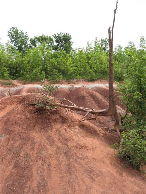
They look amazingly like the Drumheller Badlands in Alberta. More amazing is how long these Cheltenham Badlands took to form. 10,000 years? 1 Million? In this case the best person to ask is a local farmer. The Cheltenham Badlands Is made up of weathered Queenston Shale. In the early 1900s trees were cut down to allow for a cattle pasture. The protective layer of vegetation was removed and the shale began to erode. By 1931 the land was no longer useful for farming. From that time to the present only 80 plus years has elapsed. Far faster than any uniformitarian rates of erosion. This quick erosion rate forces us to rethink all erosion rates, especially Drumheller.
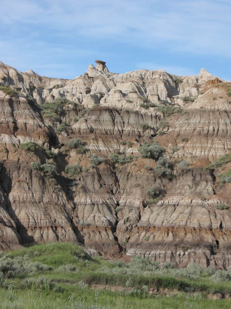
The Badlands of Drumheller Alberta.
Cheltenham badlands looking South.
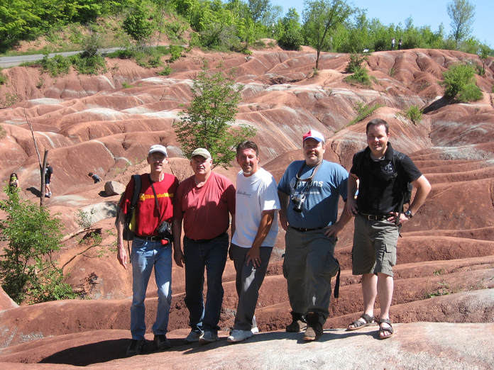
Research Team; Martin Legemaate, Stan Jerry, Dave Milligan, Ian Juby and Vance Nelson.
CONCLUSION
Processes in the past are just assumed to be slow and steady (called uniformitarianism) but it's always good to see these mini modern quick processes to remind us of what a worldwide disaster can do to the planet..... such as Noah's Flood!
Processes in the past are just assumed to be slow and steady (called uniformitarianism) but it's always good to see these mini modern quick processes to remind us of what a worldwide disaster can do to the planet..... such as Noah's Flood!
CHELTENHAM BADLANDS LOCATION
Use the interactive map to plan your route.
Use the interactive map to plan your route.
STATS:
ADDRESS: 1501-1901 Olde Base Line Rd, Caledon, ON
TIME NEEDED IF IN GTA: Half a day
FEE: Free
AMENITIES: None
Due to the popularity of the badlands it has accelerated the erosion rates simply by people just walking around on it. Thus access is no longer allowed; however it can still be seen at a viewing area at Olde Base Line Road (12).
We will be looking for alternative sites where which you can actually walk on the Queenston Shale.
Stay Tuned!
OCTOBER 2019 UPDATE
Although you still can not walk on the Cheltenham Badlands they have built boardwalks around it to view it from different angles.
We have now done some research and found an alternative site where you can actually walk on the Queenston Shale!
We have now done some research and found an alternative site where you can actually walk on the Queenston Shale!
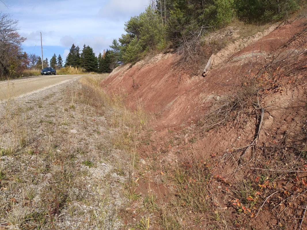
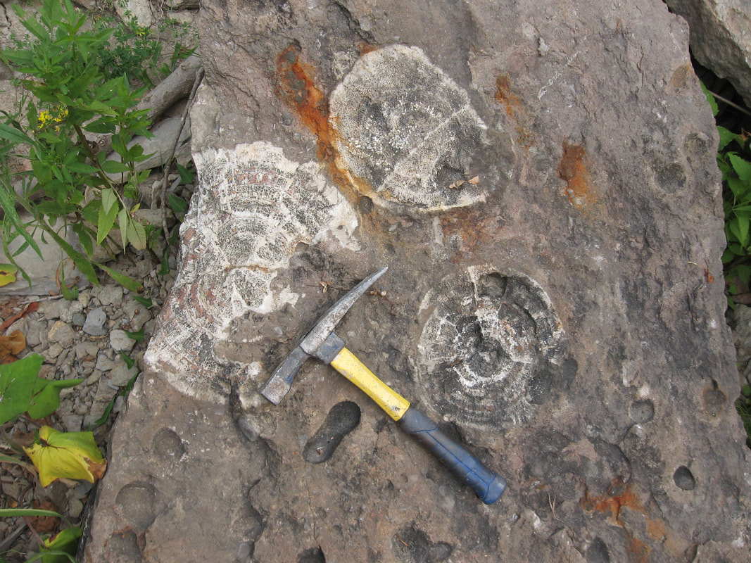
Road cut exposing the Queenston Shale just south of Creemore.
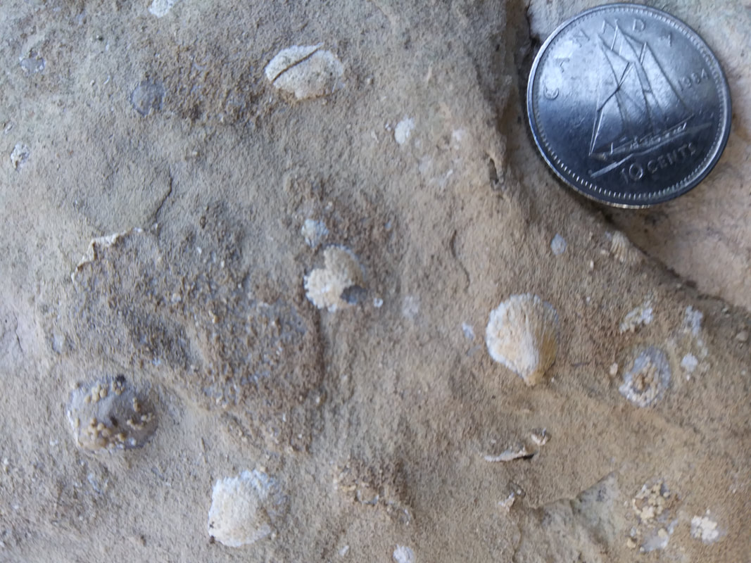
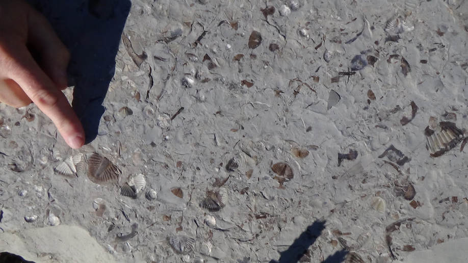
This location does have some sparse fossils that are in the glacial rocks above, Here are some fossil shells.
|
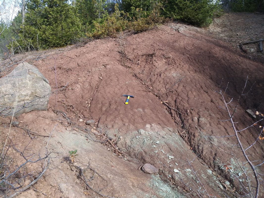
Note the weathered furrows! See hammer for scale.
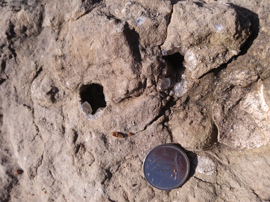
Also found here (although also sparse) are vugs (cavities) with crystals in them.
|
STATS:
ADDRESS: 798601-798699 Concession Road 5 (3 Line)
(Road heading South out of Creemore ON).
TIME NEEDED IF IN GTA: A whole day when combined with Cheltenham.
FEE: Free
AMENITIES: None
HAZARDS: The site is a road cut so watch for cars. Park at the top of the hill
and walk down or park where the road widens.
QUEENSTON SHALE ROAD CUT LOCATION
Use the interactive map to plan your route.
Use the interactive map to plan your route.
NUMBER 3
EVIDENCE: QUICK BURIAL, LARGE SCALE FLOODING, INTELLIGENT DESIGN
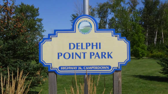
DELPHI POINT PARK, CRAIGLEITH ONT., OIL SHALE EXPOSURES
OF THE WHITBY FORMATION
EVIDENCE: QUICK BURIAL, LARGE SCALE FLOODING, INTELLIGENT DESIGN
DELPHI POINT PARK, CRAIGLEITH ONT., OIL SHALE EXPOSURES
OF THE WHITBY FORMATION
|
|
|
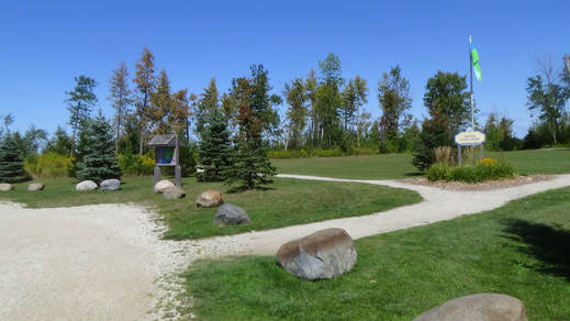
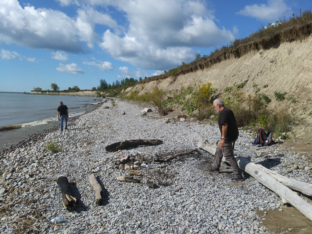
Arriving at the location you'll find a nicely manicured park
|
Trails lead to interpretive signs and eventually to the oil shale exposures at the bay
|
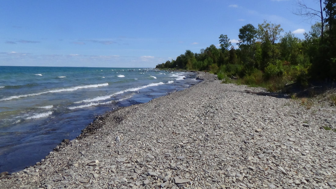
The shale beach looking South
|

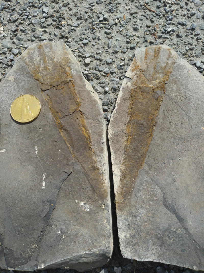
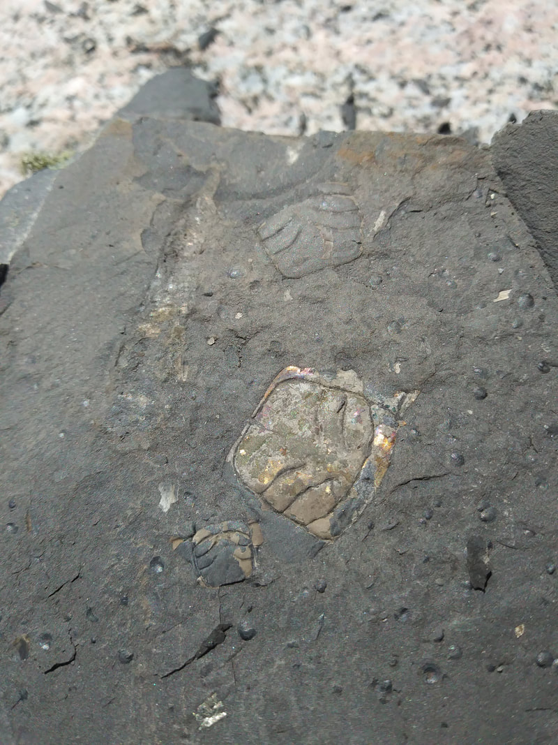
Marc Kenyon located an oil shale slab with several trilobite bits on it.
|
Close-up of the slab. Marc is pointing to a trilobite tail, the most common part of the trilobite, Pseudogygites latimarginatus.
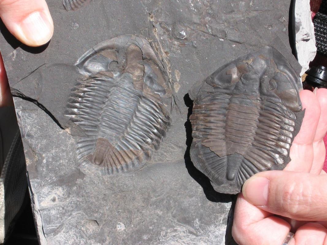
A complete trilobite (and cast) found on the site years before the park was in place. Sadly there is no collecting on the park grounds. Now the fossils are left to be destroyed by the elements. However according to a R.O.M. Royal Ontario Museum field guide, collecting loose material is still permitted outside the park as you walk West or East along the shore line. No hammers please! Shoreline may be submerged during high water blocking access!
What is a trilobite you might ask?
Eye Spy!
Trilobites are extinct arthropods (animals with an external skeleton) similar to crabs and lobsters.
Evolutionists claim life began as primitive forms which evolved into more complex forms, however, trilobites had eyes not only with double lensing systems, but they had Fresnal type lenses. It was Augustin Jean Fresnal who re-invented such lenses for light houses - so we name them after their creator. But a trilobite had Fresnel type lenses because it was programmed into their DNA which requires far more creative genius than Fresnal. It also totally disproves the idea of a primitive to complex sequence in the fossil record. The trilobites at the bottom have optical systems as advanced as space age technology. The Trilobite, with its space age“designer eyes”, can help you prove the point that God thought of it first!
(Ref. Creation News, 1999, Vol. 13 No. 1.)
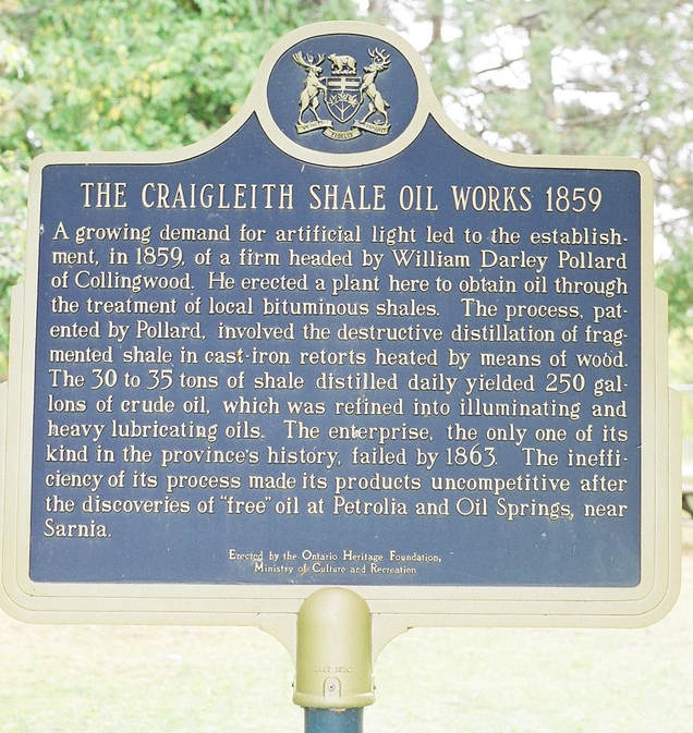
Where does the "oil" in the oil shale come from?
There's Oil in Them Thar' Rocks!
The Whitby shale is known as an oil shale. When you split it open
you can smell it. Freshly split slabs in parts of the formation can
even be ignited. In Craigleith they extracted the oil from the shale
in the 1800’s to produce different petroleum products.
Plant and animal matter were buried so quickly in such numbers
that they were preserved and converted into oil. If plants and
animals died and were slowly covered, no oil would have been
produced. The presence of oil in today’s world can be explained
by a past catastrophic worldwide flood like the one described
in the bible, Genesis 7: 18-20.
There was so much oil in the shale that in the 1800s they removed it for commercial use!
How big is this oil shale bed?
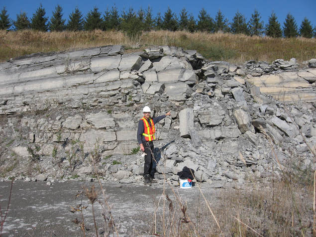
Martin Legemaate pointing to a the same Whitby Oil Shale Formation at St. Marys Quarry in Bowmanville Ontario.
Sedimentary rock is rock that was laid down by water. A sedimentary rock “bed” or formation is a layer of sedimentary rock that is distinguishable from the layer above and the layer below. How big is the Whitby Shale Formation? It runs underneath Southern Ontario with exposures at Craigleith, Pickering, Whitby and Bowmanville in St. Marys quarry. This same bed also peeks out on Manitoulin Island hundreds of kilometers away. But that's not all. The Formation is part of a continuous belt of Middle to
Upper Ordovician black shale and is present from the Central Appalachians to the Maritime Provinces. Oil Shales have been found on Baffin Island and have been correlated* with the Whitby Oil Shales. (Roy 1941)
Geological Survey of Canada, Open File 1502 By Macauley, G
Upper Ordovician black shale and is present from the Central Appalachians to the Maritime Provinces. Oil Shales have been found on Baffin Island and have been correlated* with the Whitby Oil Shales. (Roy 1941)
Geological Survey of Canada, Open File 1502 By Macauley, G
|
|
|
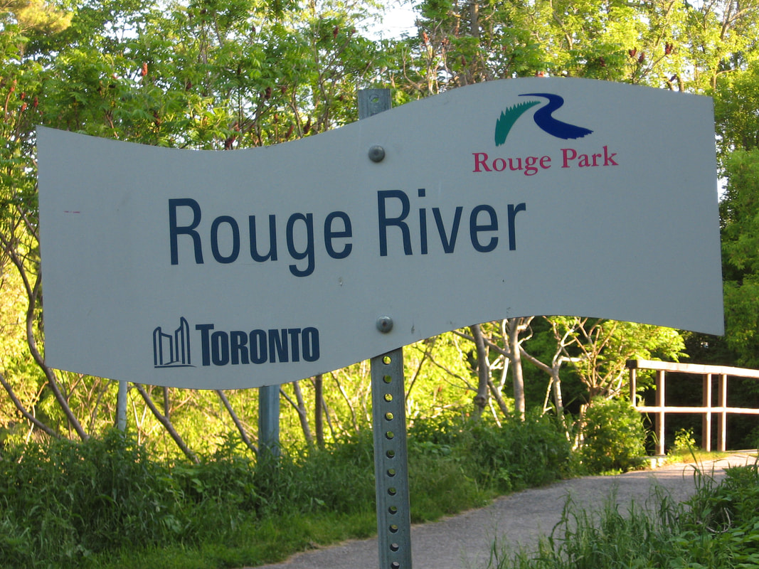
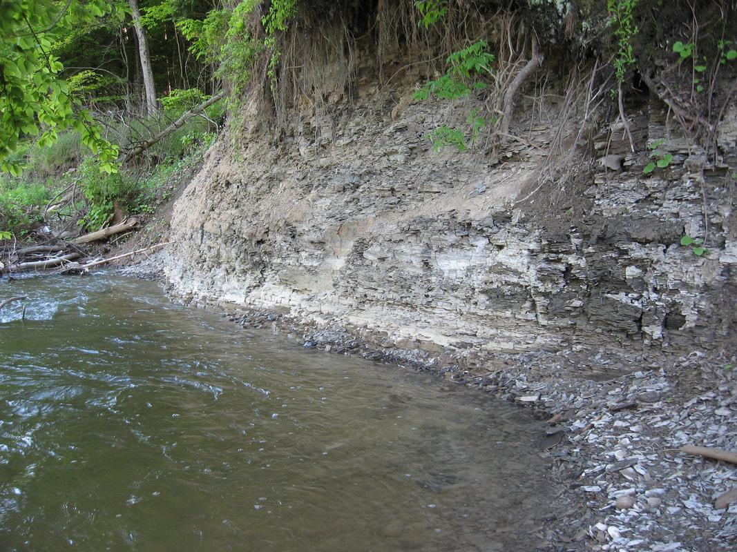
Rouge River Park in Pickering Ont..
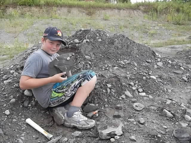
Mitchell found some great Whitby Oil Shale slabs in none other than, Whitby Ont.
|
Whitby Formation exposure along the Rouge River.
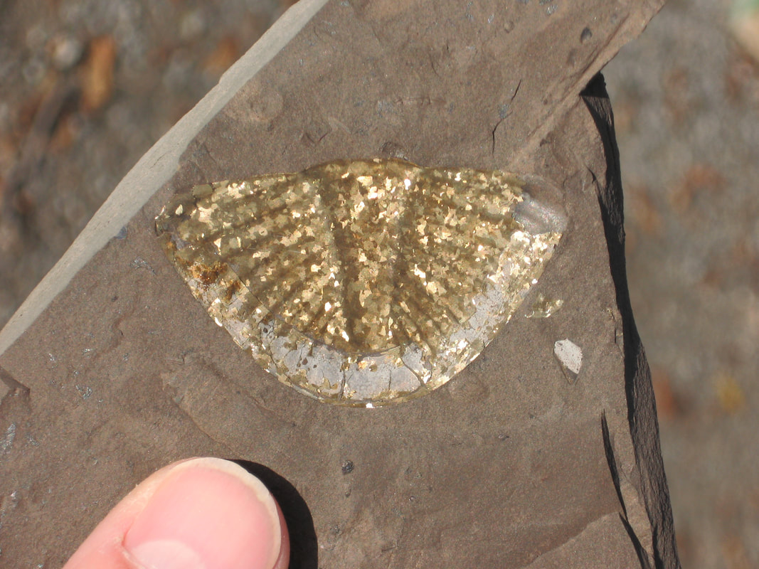
Pyritized trilobite tail. Whitby Formation, Whitby Ont.
|
Conclusion!
The Whitby Formation is great evidence that something big happened in the past because of the size of the bed and that something fast happened in the past because of the presence of the oil and well preserved fossils. It’s about time geologists once again connected these huge beds with the catastrophic event of Noah’s Flood!
The Whitby Formation is great evidence that something big happened in the past because of the size of the bed and that something fast happened in the past because of the presence of the oil and well preserved fossils. It’s about time geologists once again connected these huge beds with the catastrophic event of Noah’s Flood!
DELPHI POINT PARK LOCATION
Use the interactive map to plan your route.
Use the interactive map to plan your route.
STATS:
ADDRESS: 209233 Highway 26 , Craigleith, ON
TIME NEEDED IF IN GTA: One day
FEE: Free
AMENITIES: Picnic tables, pavilion and washrooms
ADDRESS: 209233 Highway 26 , Craigleith, ON
TIME NEEDED IF IN GTA: One day
FEE: Free
AMENITIES: Picnic tables, pavilion and washrooms
Have some extra time? Visit the little museum in the old Craigleith train station a few kms. back. There are a few displays on the fossils and the oil shale works.
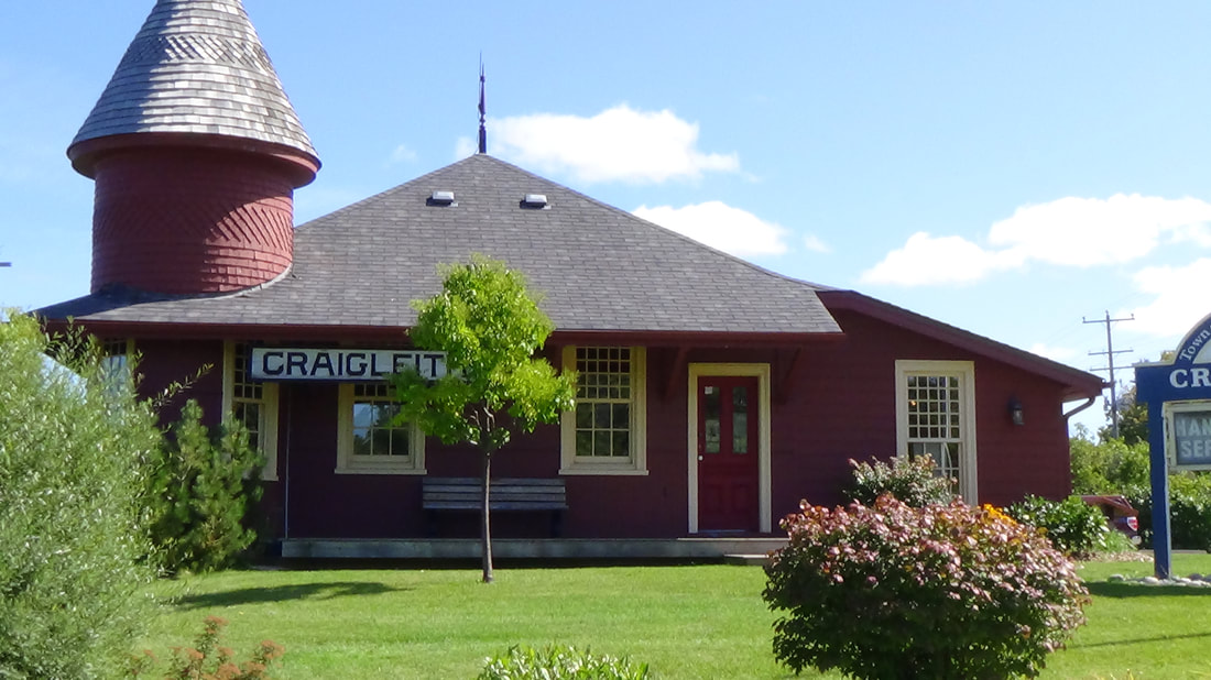
The Craigleith Museum
|
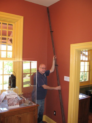
In the museum is Marc Kenyon holding a spear used to separate the shale slabs in preparation to cook the oil out of the shale.
|
THE CRAIGLEITH HERITAGE DEPOT LOCATION
Use the interactive map to plan your route.
Use the interactive map to plan your route.
STATS:
The Craigleith Heritage Depot 113 Lakeshore Road East, The Blue Mountains, ON.
Website for hours of operation: http://www.museumsontario.ca/museum/The-Craigleith-Heritage-Depot
FEE: By donation
AMENITIES: Washrooms
The Craigleith Heritage Depot 113 Lakeshore Road East, The Blue Mountains, ON.
Website for hours of operation: http://www.museumsontario.ca/museum/The-Craigleith-Heritage-Depot
FEE: By donation
AMENITIES: Washrooms
WHITBY OIL SHALE ALTERNATIVE FOSSIL COLLECTING SITE
OCTOBER 2021 UPDATE
A good alternative collecting site that may be closer to you is at the bottom of Thickson Road in none other than Whitby Ontario.
Below is an excerpt from a visit we had in September.
Below is an excerpt from a visit we had in September.
A view of the Lake Ontario Shoreline at Thickson's Point where we find the glacial till. Note the point in the background.
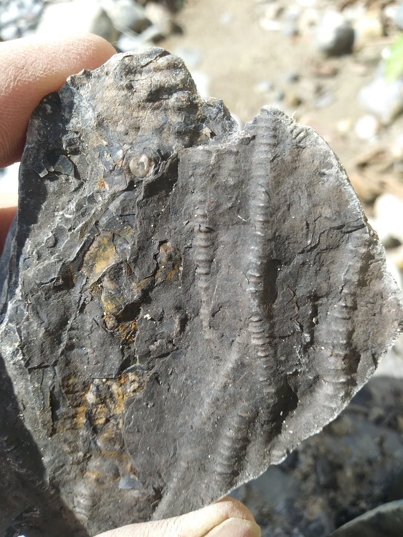
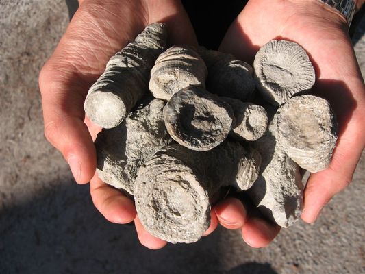
Some of the great fossils you might find are, Orthocones (Straight coned Nautiloids)
Trilobite bits
|
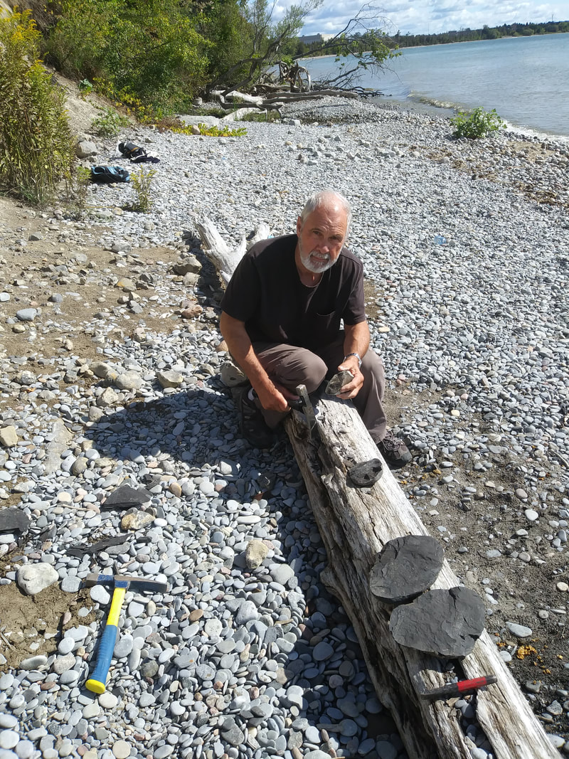
Peter cracking open some glacial till rocks. The black ones are a tell tale sign that they are oil shale. There is actually no true Whitby Oil Shale Formation exposure here but plenty of glacially distributed rocks broken off from that formation to give us lots of fossil collecting action.
Crinoids
Complete trilobites and more!
|
STATS:
ADDRESS: 2707-2601 Thickson Rd. S , Whitby, ON
TIME NEEDED IF IN GTA: Half a day
FEE: Free
AMENITIES: None
Hints: Park in the lot and walk west on the trail to a sign.
For the easiest way down the embankment take the left trail just before the sign,
follow the trail to a culvert and that will lead you down to the lake.
Locate and split the dark black rocks.
HAZARDS: Hard to get down the embankment to the shore in most areas.
May be the occasional dead fish or even birds. You may encounter high water.
Need a guide for your group?
Contact Curator Martin Legemaate. Email: [email protected]
Contact Curator Martin Legemaate. Email: [email protected]
NUMBER 4
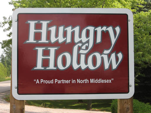
EVIDENCE: QUICK BURIAL,
HUNGRY HOLLOW CLAY BEDS,
HUNGRY HOLLOW ONT.
EVIDENCE: QUICK BURIAL,
HUNGRY HOLLOW CLAY BEDS,
HUNGRY HOLLOW ONT.
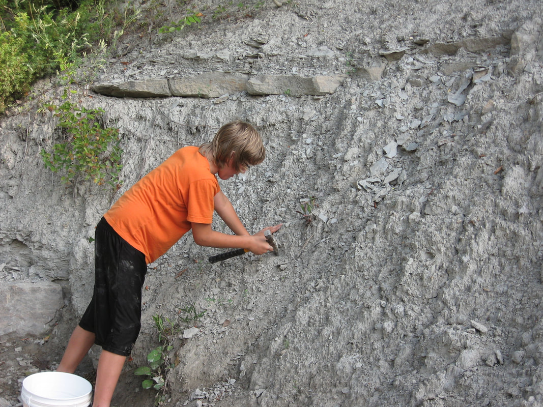
The Ausable River winds through this area exposing the Hungry Hollow, Widder, and Arkona rock formations. This is a renowned site and have met people that came from the U.S. and even Germany to collect. Why so popular? Because instead of the fossils being in a sedimentary rock matrix they are in clay. As the clay quickly erodes away the fossils fall out and can be picked up off the ground. No hammer necessary!
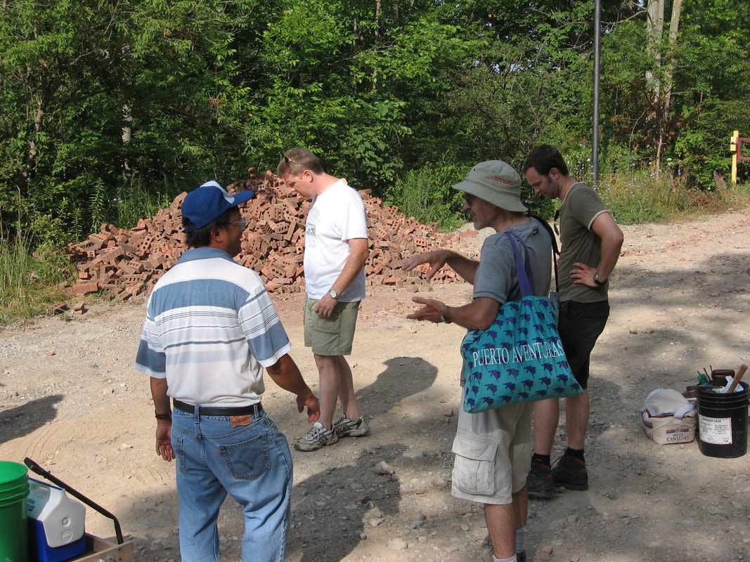
The Kawartha Rock and Fossil Club gathering in the morning for a good day of collecting.
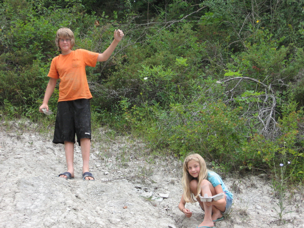
Danny Vanstemp and Miriam Legemaate picking up fossil treasures along the Ausable River bed.
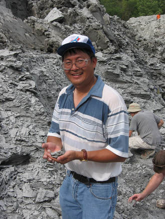
Peter finds a trilobite.
|
Danny Vanstemp picking at the loose fossils in the clay bed along Fossil Rd.
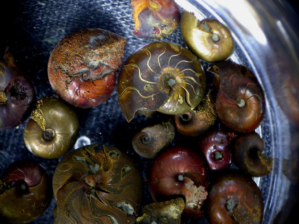
You need a good eye but you can pick out very small ammonites that have weathered out of the clay. Photo taken after the ammonites have been cleaned up. Photo courtesy of Peter Lee.
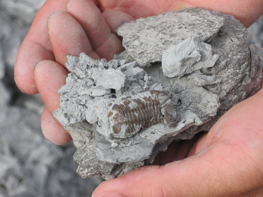
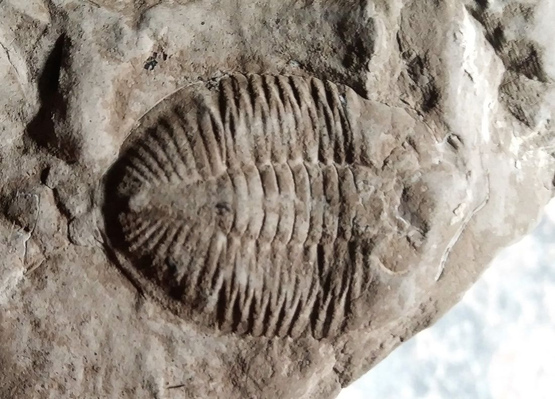
Close up of the trilobite, Phacops.
|
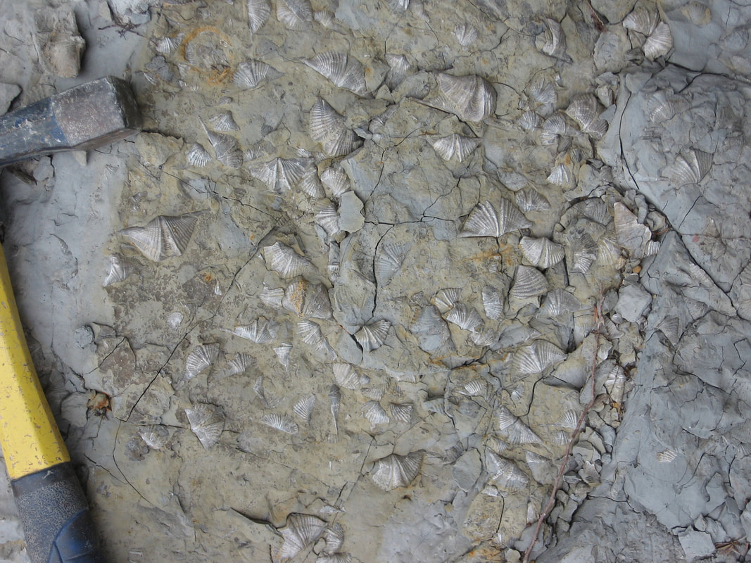
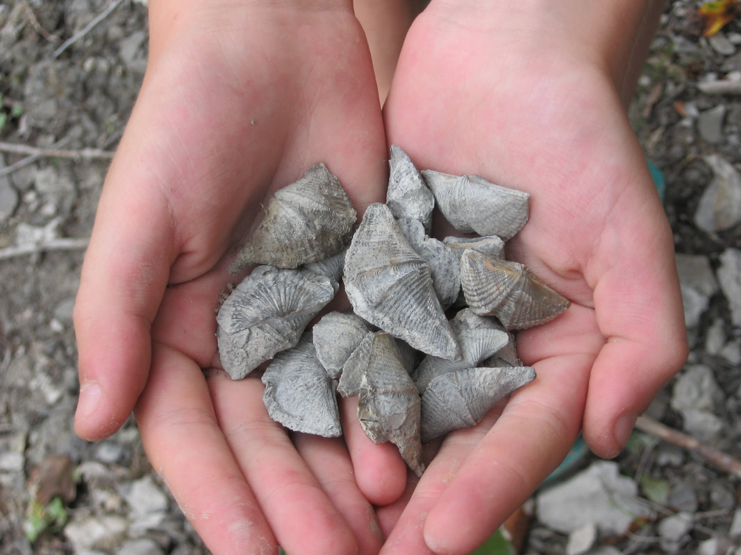
A slab of Mucrospirifer Brachiopods with shining pealry shells
Amazing horn and rugose coral can be found here in abundance!
Beautiful coral along the Ausable River.
|
Unfossilized Fossils? Exactly!
These Mucrospirifer Brachiopods picked up out of the clay matrix were found unfossilized showing the pearly shell intact as if they were living. These Middle Devonian brachiopods are considered to be 350 million years old but only a recent flood can better explain such amazing preservation. Noah’s Flood which occurred about 4000 years ago fits this evidence perfectly! 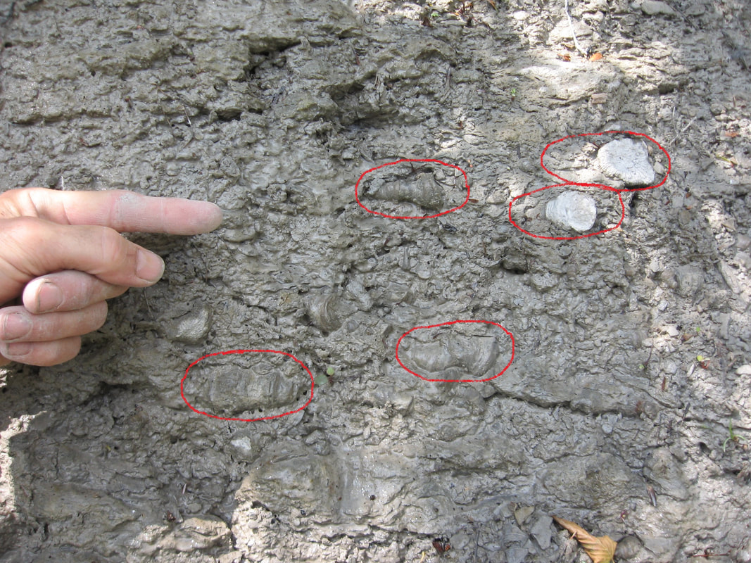
Photo of the river bed as it cuts through several formations leaving a "window" into the strata. Some amazingly preserved horn coral in the Hungry Hollow Formation are revealed but not in living positions as the text books show but rather faced in all directions with many washed in, laying down and even upside down. This bed clearly shows another of many fossil dump deposits in Ontario.
|
FOSSIL ROAD AND AUSABLE RIVER CLAY BED LOCATIONS
Exposures along fossil Rd. and the river bed.
Use the interactive map to plan your route.
Exposures along fossil Rd. and the river bed.
Use the interactive map to plan your route.
STATS:
ADDRESS: Fossil Rd. Arkona, ON
TIME NEEDED IF IN GTA: One (long) day.
FEE: Free
AMENITIES: None
ADDRESS: Fossil Rd. Arkona, ON
TIME NEEDED IF IN GTA: One (long) day.
FEE: Free
AMENITIES: None
For a street view to see the Fossil Rd. clay beds click: CLAY BEDS
While your in the area visit the Rock Glen Conservation area. You may collect 1 of each type of fossil in the park. Visit the extensive fossil museum to brush up on fossil identification.
Picturesque Rock Glen Fall in the park.
ROCK GLEN CONSERVATION AREA LOCATION
Use the interactive map to plan your route.
Use the interactive map to plan your route.
STATS:
ADDRESS: 8680 Rock Glen Rd, Arkona, ON N0M 1B0
TIME NEEDED IF IN GTA: 2 days if combining Hungry Hollow.
FEE: $4 per person, $3 per student in a school group.
AMENITIES: Washrooms, Museum, Picnic areas.
ADDRESS: 8680 Rock Glen Rd, Arkona, ON N0M 1B0
TIME NEEDED IF IN GTA: 2 days if combining Hungry Hollow.
FEE: $4 per person, $3 per student in a school group.
AMENITIES: Washrooms, Museum, Picnic areas.
NUMBER 5
EVIDENCE: QUICK PROCESSES, DEEP SEDIMENT DEPOSITION
KETTLE POINT CONCRETIONS, KETTLE POINT ONT.
EVIDENCE: QUICK PROCESSES, DEEP SEDIMENT DEPOSITION
KETTLE POINT CONCRETIONS, KETTLE POINT ONT.
Miriam Legemaate and Danny Vanstemp checking out a kettle at a small parkette at Kettle Point.
Concrete Evidence!
Kettles or concretions are blobs of sedimentary rock that form within already laid down sedimentary strata. Concretions have long been regarded as geological curiosities and have been misinterpreted as being dinosaur eggs or even human artifacts.
A concretion can be formed by growing in layers from the center outward (concentric) or by the infilling of pore space by minerals
(pervasive) occurring simultaneously throughout the volume of the area. Each type forms within the already laid down
strata. Ref. http;//en.wikipedia.org/wiki/Concretion
The obvious conclusion is that the host strata was still soft when the concretions were formed which doesn’t fit evolutions
slow burial model.
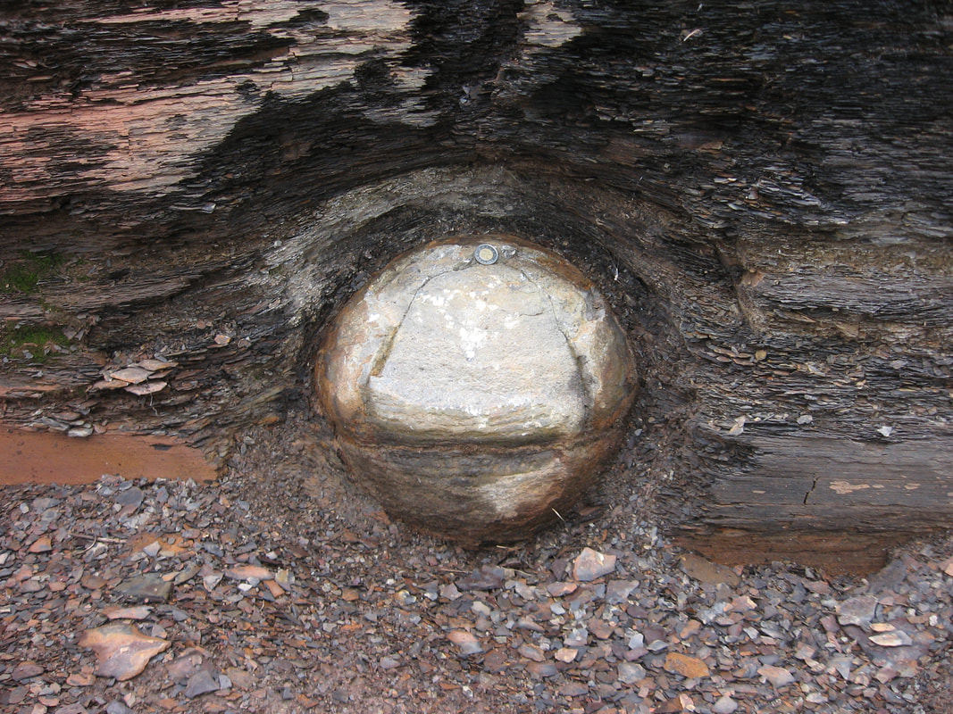
Another kettle displayed at the parkette.
This kettle is insitu or still in place in the shale. Note the toonie for scale.
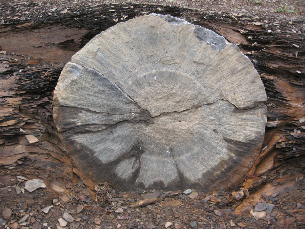
A cross section of a kettle showing the crystals
radiating out from the center. 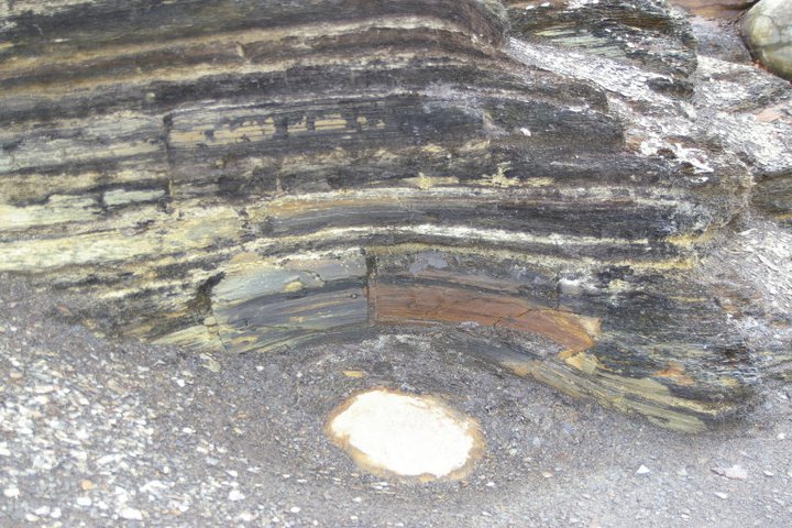
The kettles are all at different levels in the shale. This one is just peeking out of the shale beach floor.
|
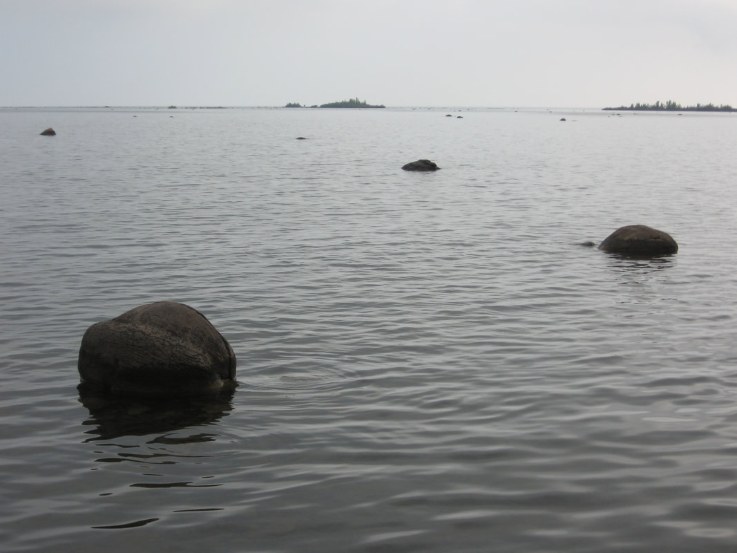
As you look out into the shallow waters of Lake Huron you can see more kettles peeking out.
Note also the draping shale over the kettle.
These amazing crystallized concretions occur in only a few locations on earth one of them being at Kettle Point on Lake Huron only a few hours drive from Toronto. Diameter sizes
range from 0.3m to 1.5m. What makes them amazing is that they are crystallized from the center radiating outward. As they grew they pushed the surrounding muds outward.The obvious “draping” of the shale around the concretion shows it formed and hardened before the host sediment was compacted. 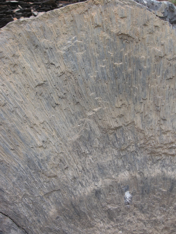
Close up of a cross section showing the radiating lines.
Thanks to Peter Lee for some of the images. |
These Kettle Point concretions fit perfectly with the catastrophic flood model in 3 main ways.
There must have been multiple meters of soft sediment laid down to allow these concretions to
grow and they hardened quickly before sediment was compacted because of the obvious draping
effect around the (uncompacted) concretion.
The crystallization of the concretion was due to a process called “bacterial sulphate reduction” which
requires organic matter (dead things) to be present in the host sediment. In fact so much organic matter
is present *“as to make the rock flammable”. All this must happen in a low or no oxygen environment.
The surrounding Kettle point shale is a huge formation that extends across much of the Eastern
USA (called the Ohio Shale) and parts of Central Canada indicating massive flooding in the past.
Ref. *Reginald A. Daly, The Journal of Geology, Vol. 8,No. 2, page 136. The University of Chicago Press.
Ref. The Origin of the “Kettles” at Kettle Point Lake HuronMario Coniglio www.whaton.uwaterloo.ca/waton/f901.html
KETTLE POINT PARKETTE LOCATION
Use the interactive map to plan your route.
Use the interactive map to plan your route.
STATS:
ADDRESS: 9690-9742 Lake Rd. Kettle Point ON.
TIME NEEDED IF IN GTA: 1 (long) day. 2 days if combining Hungry Hollow and/or Arkona.
FEE: Free
AMENITIES: Benches, Unsupervised swimming.
Collect loose shale material only. No hammers. The Kettles are protected.
Small Marcasite concretions along the shore may be collected.
NUMBER 6
EVIDENCE: RECENT EROSION
THE FLOWERPOT FORMATIONS, FLOWERPOT ISLAND, TOBERMORY ONT.
EVIDENCE: RECENT EROSION
THE FLOWERPOT FORMATIONS, FLOWERPOT ISLAND, TOBERMORY ONT.
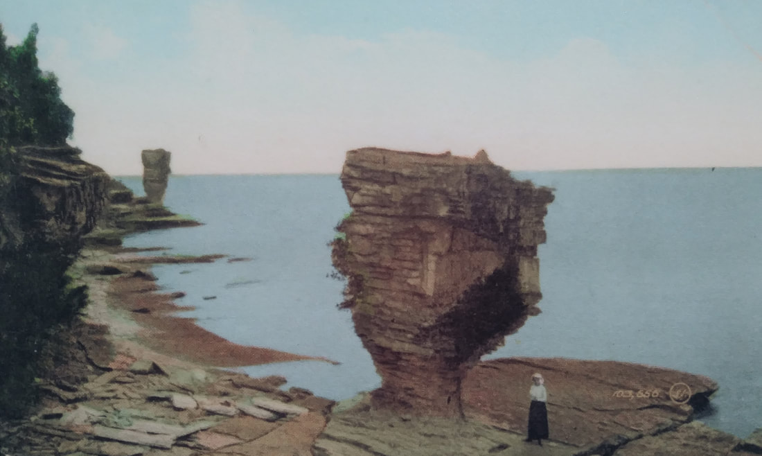
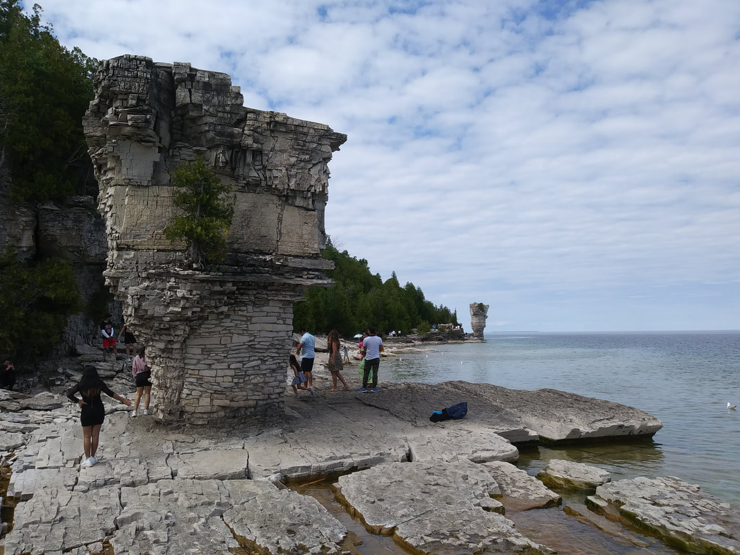
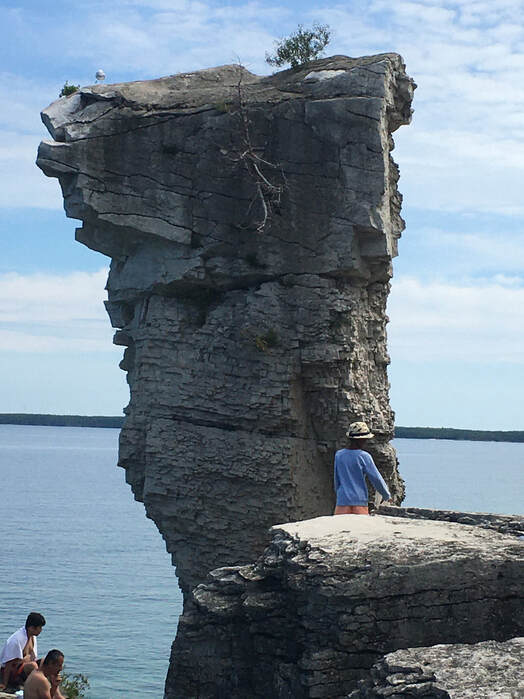
Flowerpot rock formations (or generally known as sea stacks) form as water erodes rock at and around the edges of cliff walls. The formation is finally separated from the main body of rock to form a flowerpot. The Flowerpot Island flowerpots are thinner at the bottom due to a softer rock type there. These particular flowerpots were a result of glacial melt water, eroding rock to create cliffs, caves and flowerpots.
|
|
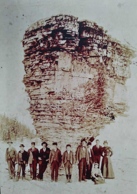
It was surveyors in the 1820s that named these structures flowerpots.
Plaques around Tobermory and the island show that these fascinating structures have attracted tourists since the early 1900s.
Plaques around Tobermory and the island show that these fascinating structures have attracted tourists since the early 1900s.
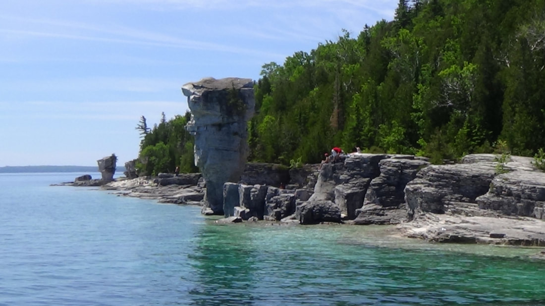
On the ferry making our way to the island. A view from the boat of the north and south flowerpots.
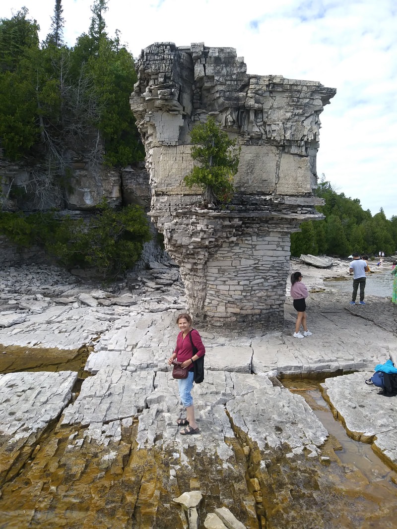
Salome posing in front of the south flowerpot in 2021.
.A view of the south flowerpot with the north one in the background.
|
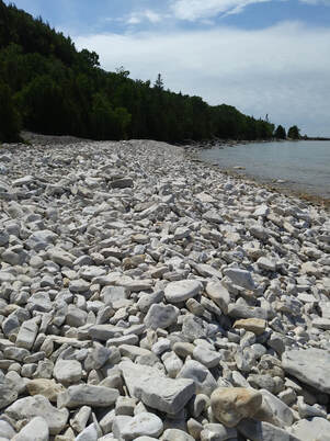
The island's base is made up of Silurian limestone and dolostone. Beautiful limestone cobbles make up the surrounding beaches.
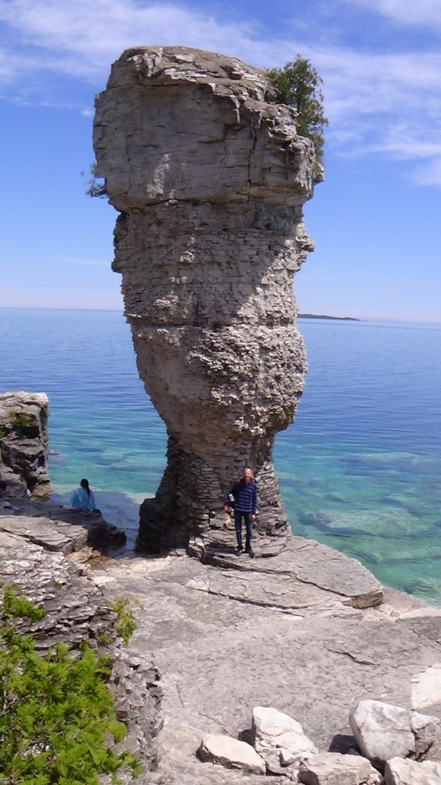
A good shot of the larger north flowerpot taken in 2015.
|
So how long does a flowerpot take to form?
We are conditioned to believe these structures have been around for long periods of time and sadly some articles even say they take *millions of years to form.
(*https://global.hurtigruten.com/destinations/iceland/inspiration/what-is-a-sea-stack/)
The standard long age view is that these started forming about *10,000 years ago at the retreat of the last ice age.
(*Page 58 The National Parks in Ontario A Story of Islands and Shorelines)
Taking a close look at the flowerpots reveals that these have been repaired and modified to slow down the process of erosion. Here at the north flowerpot, the top has been cemented to allow water to run off, thus reducing frost damage.
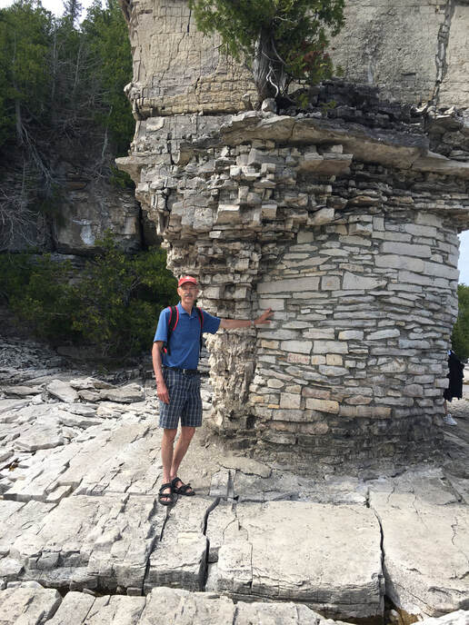
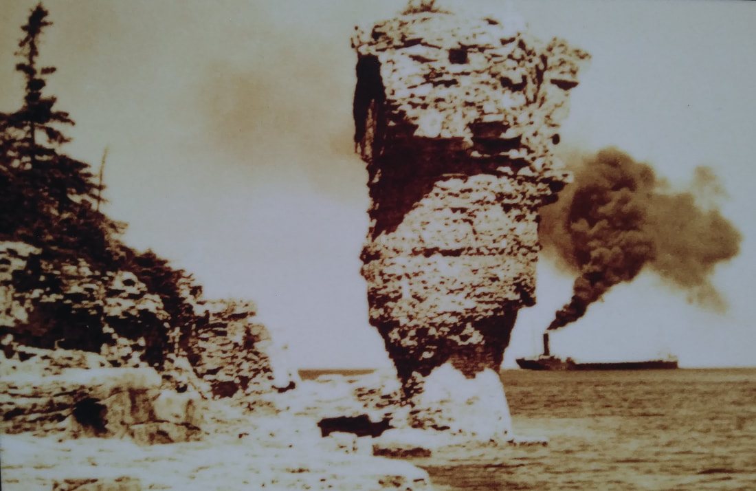
Here at the south flowerpot you can clearly see the masonry work done to prevent the flowerpot from toppling. It is not well known, but there used to be 3 flowerpots. One collapsed in 1903 (possibly long before modifications were done).
Where would the flowerpots be if they had not been modified? They would be already gone.
"The main flowerpot is this tall stack, made of thin-bedded limestone on the bottom with a more thickly bedded unit on the top. To preserve this natural feature, some masonry work has been done around the bottom and a waterproof capping of concrete placed on top. In the normal course of events it would have been eroded away by this time". Page 49 The National Parks in Ontario A Story of Islands and Shorelines
"The main flowerpot is this tall stack, made of thin-bedded limestone on the bottom with a more thickly bedded unit on the top. To preserve this natural feature, some masonry work has been done around the bottom and a waterproof capping of concrete placed on top. In the normal course of events it would have been eroded away by this time". Page 49 The National Parks in Ontario A Story of Islands and Shorelines
People were surprised when one of the famous "12 apostle" sea stacks on Australia's coastline collapsed on July 3, 2005. This surprise is due to being conditioned to believe that things are millions of years old.
( https://creation.com/twelve-apostles-shock)
( https://creation.com/twelve-apostles-shock)
CONCLUSION:
Clearly, as you dig a little deeper, natural processes of erosion and deterioration are a lot faster than first thought. This would cause the earth to be viewed in a much younger light. The better explanation for the formation of these flowerpot structures than long ages is the biblical timeline. The great flood of Noah's time, about 4000 years ago, would have laid down most of the sedimentary rock around the world, including the rock in this area. The runoff of the flood waters would have re-eroded some of that rock. Then, with the effects of the flood ushering in the Ice Age, that would have created even more erosion as the glaciers retreated, leaving the geological features we see today.
Clearly, as you dig a little deeper, natural processes of erosion and deterioration are a lot faster than first thought. This would cause the earth to be viewed in a much younger light. The better explanation for the formation of these flowerpot structures than long ages is the biblical timeline. The great flood of Noah's time, about 4000 years ago, would have laid down most of the sedimentary rock around the world, including the rock in this area. The runoff of the flood waters would have re-eroded some of that rock. Then, with the effects of the flood ushering in the Ice Age, that would have created even more erosion as the glaciers retreated, leaving the geological features we see today.
TOBEMORY LOCATION
Use the interactive map to plan your route.
Use the interactive map to plan your route.
STATS:
ADDRESS: Highway #6, northern tip of the Bruce Peninsula, Tobermory, Ont.
TIME NEEDED IF FROM THE GTA: 2 days
FEE: Ferry fee to the island
AMENITIES: Tobermory: Hotels and restaurants.
Flowerpot island: Washrooms and picnic areas.
HOTEL INFO: https://tobermory.com/where-to-stay
FERRY INFO: https://www.cruisetobermory.com/
NUMBER 7
EVIDENCE: QUICK EROSION
NIAGARA FALLS AND GORGE, NIAGARA FALLS ONT.
EVIDENCE: QUICK EROSION
NIAGARA FALLS AND GORGE, NIAGARA FALLS ONT.
When we think of geological wonders the first thing that probably comes into mind is Niagara Falls. For centuries Niagara Falls has attracted Native Americans, explorers, surveyors, pioneers and tourists alike. Its size and the volume of water rushing over the rock escarpment is unparalleled for North America.
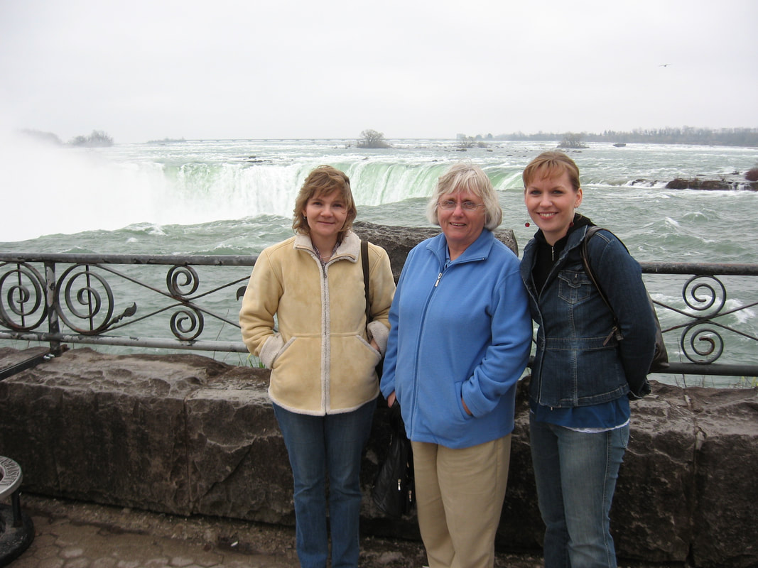
Salome Legemaate, Anne Mackay and Korelei Nelson at the Falls in 2007.
|
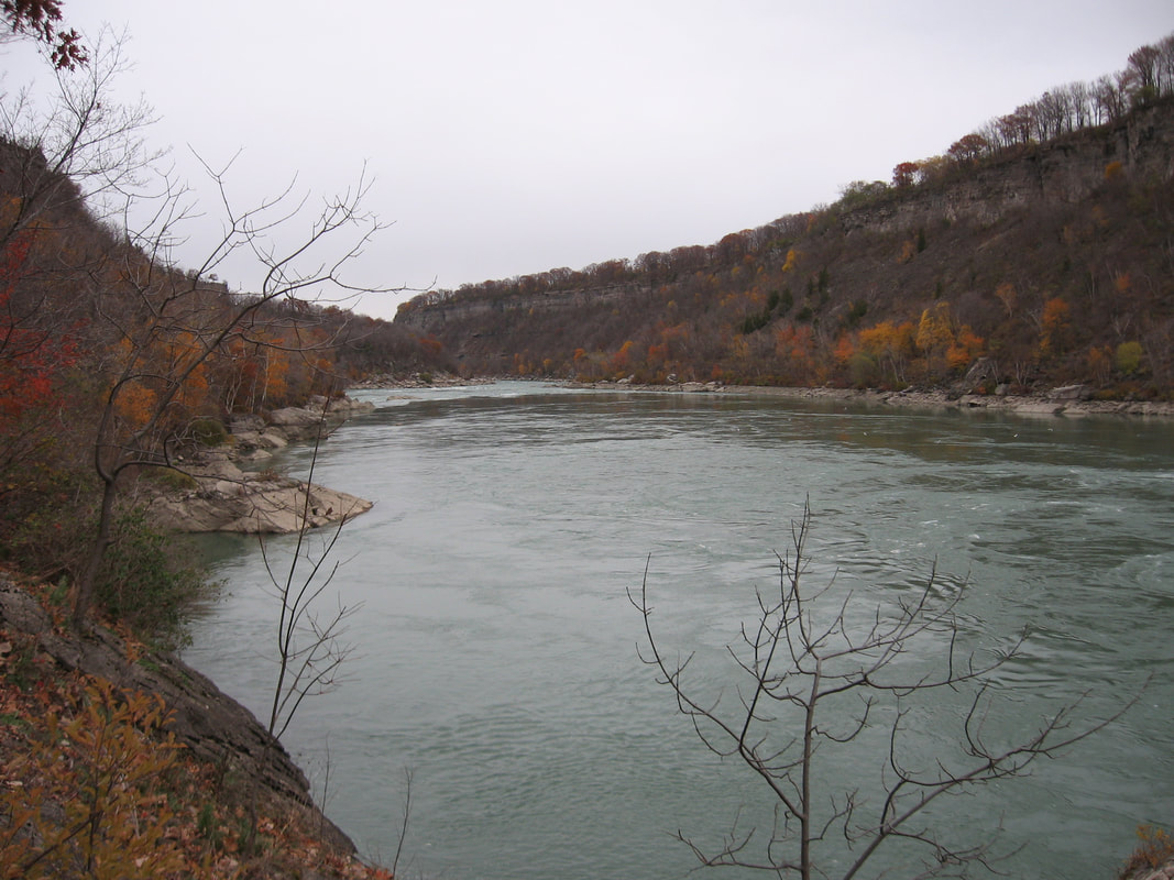
Looking northward at the gorge from the whirlpool.
|
Equally impressive is the gorge, separating Lake Erie from Lake Ontario. How long would it have taken for that gorge to have been cut by water, sand, and silt?
It was in 1841 that lawyer turned geologist Charles Lyell visited the Falls. Lyell was a proponent of slow and gradual processes (uniformitarianism) and published a book, Principles of Geology. He surmised it took 35,000 years for the gorge to be cut, thus undermining the Bible’s 6000 year age of the earth. Lyell didn’t take into account the much faster rates of erosion seen by eyewitnesses (3 feet a year) but came to an erosion rate of 1 foot per year (Lyell 1867, 1:361). The math then was simple: the gorge is 35,000 feet long, thus equaling 35,000 years.
It was in 1841 that lawyer turned geologist Charles Lyell visited the Falls. Lyell was a proponent of slow and gradual processes (uniformitarianism) and published a book, Principles of Geology. He surmised it took 35,000 years for the gorge to be cut, thus undermining the Bible’s 6000 year age of the earth. Lyell didn’t take into account the much faster rates of erosion seen by eyewitnesses (3 feet a year) but came to an erosion rate of 1 foot per year (Lyell 1867, 1:361). The math then was simple: the gorge is 35,000 feet long, thus equaling 35,000 years.
At the base of the whirlpool, looking at Whirlpool Point on the US side.
|
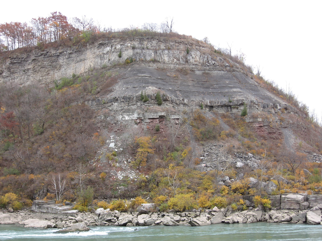
Vance Nelson and John Mackay along the gorge wall precisely at the Ordovician -Silurian contact.
|
It wasn’t until much later that the gorge was estimated at being "12,000 years old". However slow and gradual processes had been already ingrained in the populace due to the assumption in his book that “the present is key to the past” is the correct way of looking at things.
Ref. https://www.smithsonianmag.com/travel/when-niagara-falls-ran-dry-180972198/
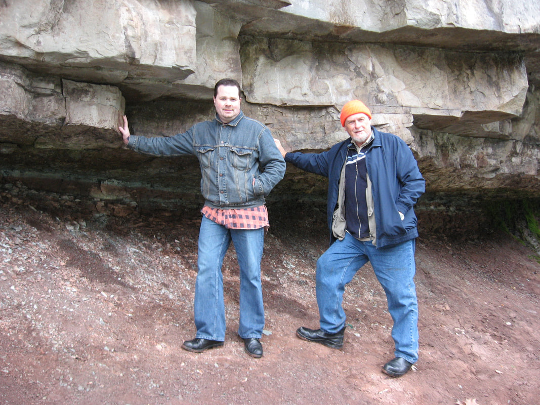
A 2007 photo of Martin Legemaate in front of one of many potholes in the Niagara Glen, just north of the whirlpool.
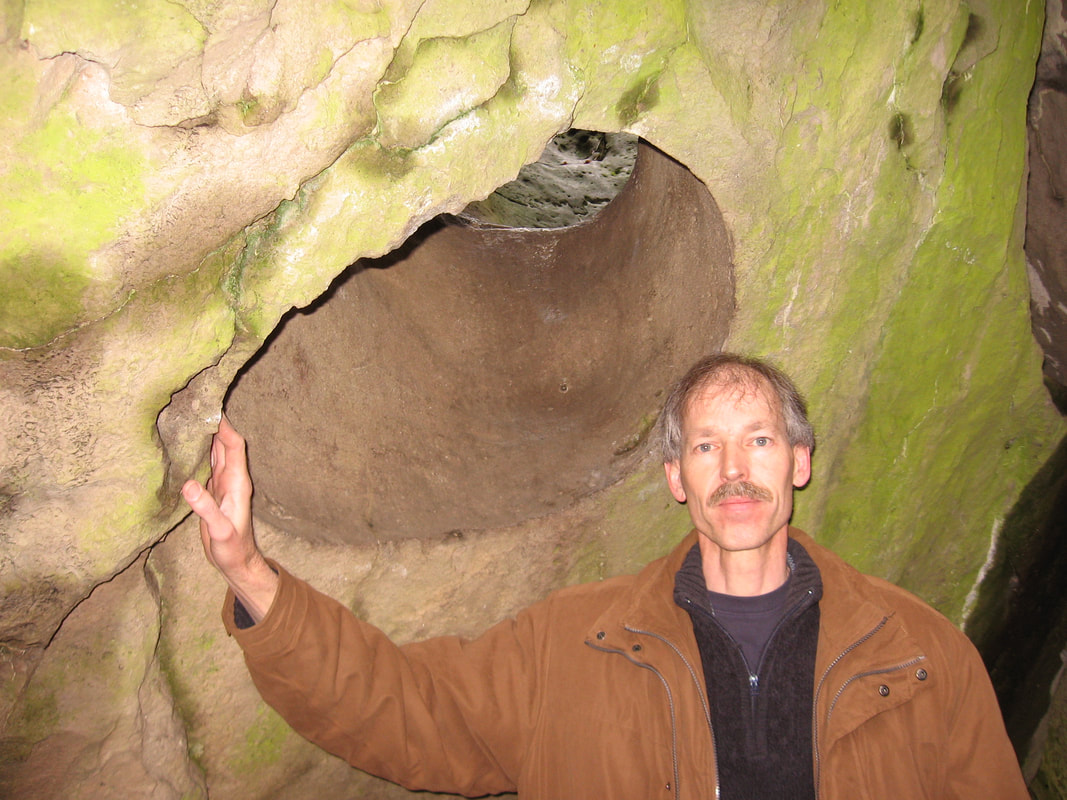
One of the many evidences of past turbulent water recorded in the rocks is known as a pothole. A pothole forms quickly as swirling, rushing water carries sand, pebbles and even cobbles, and grinds a hole into solid rock. Only torrential waters could have created potholes. These ones in the Glen were created by retreating glaciers at the end of the Ice Age.
"The generally accepted belief is that high volumes of rapidly-flowing water, probably in an ice-marginal, or possibly sub-glacial river, enlarged weak points in the bedrock and established the site for a pothole". Ref. https://uwaterloo.ca/wat-on-earth/news/glacial-potholes |
A 2021 photo of Salome Legemaate at the Niagara Glen in front of "The Mammoth Pothole".
|
To date, a section of the gorge is said to have formed in weeks or even days!
"It was a brief and violent encounter: a geological moment lasting only weeks, maybe even only days".
Ref. https://www.niagaraparks.com/visit-niagara-parks/plan-your-visit/niagara-falls-geology-facts-figures/
"It was a brief and violent encounter: a geological moment lasting only weeks, maybe even only days".
Ref. https://www.niagaraparks.com/visit-niagara-parks/plan-your-visit/niagara-falls-geology-facts-figures/
CONCLUSION
Have you noticed that as time progresses, the age of the gorge gets younger and younger?
Eventually real science and observations will catch up with the Bible!
The statement, "the present is key to the past", is only true if you rule out catastrophic processes.
Have you noticed that as time progresses, the age of the gorge gets younger and younger?
Eventually real science and observations will catch up with the Bible!
The statement, "the present is key to the past", is only true if you rule out catastrophic processes.
NIAGARA GLEN LOCATION
Use the interactive map to plan your route.
Use the interactive map to plan your route.
WHIRLPOOL TRAIL ENTRANCE LOCATION
Use the interactive map to plan your route.
Use the interactive map to plan your route.
STATS:
ADDRESS: 3050 Niagara Parkway, Niagara Falls Ont.
TIME NEEDED IF FROM THE GTA: 1 day.
FEE: Parking fee. No fee for the Glen and the Whirlpool trails.
AMENITIES SITE 1: The Glen, parking, washrooms, gift shop, picnic tables. A stairway leads down to the trails.
HAZARDS: Steep rocky pathways at the Glen.
AMENITIES SITE 2: The Whirlpool, parking at "The Fisherman's Lot"
HAZARDS: Steep steps and fast moving water at the Whirlpool.
Bibliography
https://answersingenesis.org/geology/natural-features/niagara-falls-and-the-bible
http://www.samizdat.qc.ca/cosmos/origines/niagara/niagara.htm
IN THE MINDS OF MEN, Ian Taylor, CD ROM 5th Edition
https://www.ontariobeneathourfeet.com/rockwood-potholes
https://answersingenesis.org/geology/natural-features/niagara-falls-and-the-bible
http://www.samizdat.qc.ca/cosmos/origines/niagara/niagara.htm
IN THE MINDS OF MEN, Ian Taylor, CD ROM 5th Edition
https://www.ontariobeneathourfeet.com/rockwood-potholes